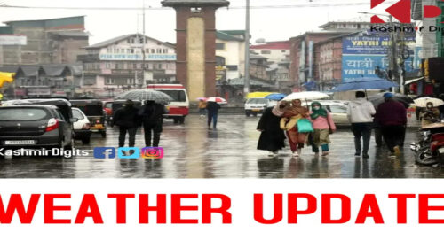
The valley may experience heavy snowfall at some places from January 5 to 6 the weatherman predicted on Friday.
It was said that some places may receive ‘heavy snow’ which may affect road and aerial transportation.
“As per today’s analysis, widespread snow/rain spell of moderate intensity is most likely during 4-6th January in both J&K and Ladakh with main activity on 5-6th,” a meteorological department official said in a statement to GNS.
“Heavy Snow is expected at some places during 5-6th,” he said, adding, “(It) may affect the surface and air transportation.” He said light snow is expected over higher reaches of Kashmir during January 2-3rd. “Expect colder days and warmer nights from January 2nd onwards,” he added.
| Install Our App | DOWNLOAD |
| Join Telegram Channel | JOIN NOW |
| Join Facebook Group | JOIN NOW |
| Subscribe YouTube Channel | SUBSCRIBE |
| Follow On Twitter | FOLLOW |
| Follow On Instagram | FOLLOW |
Meanwhile, cold conditions prevailed across J&K and Ladakh even there was slight rise in minimum temperature with Gulmarg recording a low of minus 9.0°C.
The official told GNS that Srinagar, the summer capital of J&K, recorded a low of minus 3.0°C against previous night’s minus 4.0°C. Although the temperature was above 1.0°C than the previous night, it was minus 0.9°C below normal for this time of the year.
Kashmir is presently under the grip of 40-day long harshest period of winter, known locally as ‘Chillai Kalan, which started from December 21. It is followed by a 20-day long ‘Chillai Khurd’ and a 10-day-long ‘Chilla Bachha’.